|


| |
| |
|
|
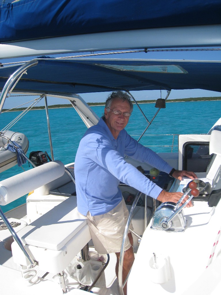
Leaving Fort Lauderdale |
|
|
|
|
|
|
|
7 January 2010
With mixed feelings, we say
farewell to all our friends in Fort Lauderdale and Pompano Beach. They have
all been so welcoming, generous and hospitable and made our extended time in
Fort Lauderdale extremely enjoyable. We will miss our weekly kayaking and
other regular get-togethers. Hopefully, many will come and visit us onboard
somewhere out in the islands.
Motored down the ICW from Kim’s dock at
Pompano Beach, through Atlantic Boulevard, Commercial Boulevard, Oakland
Park Boulevard, Sunrise Boulevard and Las Olas Boulevard opening bridges to
Bahia Mar Marina in Fort Lauderdale where we stopped to fill fuel tanks and
jerry cans.
As their fuel dock was due to close
shortly after we completed fuelling, they allowed us to stay on the dock for
a couple of hours while we prepared the boat for sea. Securing kayaks,
setting up lifelines, getting sails ready and making sure that everything we
would need was to hand.
Set off from there around 7pm after dark
further down the ICW and through the last bridge, 17th Street
Causeway, then out to sea through Port Everglades.
We had planned to sail down the coast to
Miami, to give us a better angle for crossing the Gulfstream which would
carry us north again so we could enter the Bahamas Banks at North Rock, just
north of Bimini. However, the wind and sea were calm, so we motored straight
across and were able to hold a good heading directly to North Rock.. |
|
|
|
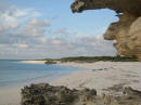
The Bahamas Banks |
|
Leaf Cay in the Exumas |
|
Leaf Cay to Long Cay |
|
Crooked Island - Long Cay |
|
Crooked Island - Fish Cay |
|
Acklins Island - Datum Bay |
|
Hogsty Reef |
|
Little Inagua |
| |
| |
| |
| |
|
|
|
|
|
|
|
|
|
|
|
|
|
|
|
|
|
| |
|
|
Sailing through the Bahamas Banks |
|
|
| |
8 January 2010
Click on picture
to enlarge image. Click Back to return to text |
|
 |
|
Passed North Rock early morning in the
dark and continued across the banks with an average of 20 foot depths in
order to make it through the North West Channel, (the narrow exit point from
the banks) in daylight. Then turned south down the very deep Tongue of the
Ocean where depths drop to 7,000 feet.
Iza had our fishing lines out before we
hit deep water. She will be out there, sun, wind, cold or rain determined to
beat the odds of us usually being in the wrong place, at the wrong time and
going at the wrong speed to catch fish.
Arrived at the Decca West day marker,
which marks the channel across the banks to the central Exumas established
by the US military when they had a Decca station on Pipe Cay in the Exumas
some years ago.
As the three channel markers were unlit
and there was no moon, we anchored just off the channel for a few hours. |
|
|
|
|
|
|
|
|
|
|
|
|
|
|
|
|
|
|
| |
|
|
Sheltering in Leaf Cay in the
Exumas |
|
|
| |
9 - 12 January 2010
Click on picture
to enlarge image. Click Back to return to text |
|

|
|
Started through the Decca Channel at 6am
on Saturday 9th, taking us through to the west side of the Central Exumas,
then out through Dotham Cut into Exuma Sound and turned south east heading
for Leaf Cay, just north of Lee Stocking Island. It's not a popular spot to
anchor and not one of the recommended major cold front hide out spots but it
is very well protected with good holding and we knew the imminent cold front
was going to be a real beaut!
Arrived in calm conditions around 3pm.
It turned out to be a great choice. No other boats to get in the way so
plenty of room to put out 200’ of heavy anchor chain. During the night we
had wind gusts up to 40 knots but only about 6” of fetch on the water. It
then blew consistently between 25 and 35 knots through Sunday 10th
and Monday 11th.
Not even 30 knots of wind and a strong
current could stop Iza from getting out in the kayak. In a strong current we
rig a catch line and float behind the boat for kayaking, swimming or diving.
12th January 2010
The wind has finally settled and it’s a
glorious Exuma day. Time to check out the diving gear and use the
opportunity to clean the props, change the prop zincs and clean off some
more of that accumulated ICW gunk from the hull. Then it's off east towards
Turks and Caicos.
|
|
|
|
|
|
|
|
|
|
|
|
|
|
|
|
|
|
|
| |
|
|
Leaf Cay, Exumas to Long Cay, Crooked Island |
|
|
| |
12 to 13 January 2010
Click on picture
to enlarge image. Click Back to return to text |
|

Almost a smiley! A wayward sail batten to be fixed.
|
|
Set off from Leaf Cay around 3pm heading
for the Turks and Caicos, knowing that if we had any problems, we had the
alternatives of Conception Island, Long Island and the Crooked/Acklins
group.
During the night, when the wind picked
up a little and we could sail, the autopilot decided not to hold course. As
we rounded Cape Santa Maria at the north point of Long Island, the wind
really picked up as did the seas. We were now hand steering is less than
comfortable conditions. It was also extremely dark with no moon and
significant cloud cover.
Daylight at last and we’re both a bit
tired hand-steering through the night with no external references, a compass
light that we realised had not been connected to our new mast head lights so
using a compass illuminated by torch and really heavy seas. Add to that a
couple of very large container ships that popped up on our Automatic
Identification System using the passage down the east side of Long Island
that were still going to be close. But we coped and it was good experience
in handling the boat.
During the trip we overheard snippets of
VHF conversation regarding a Tsunami warning. We had seen no official
warning and had no idea of the cause or where or when this might occur.
Later on we received an email from our CruiseEmail our Single
Side Band Radio email ISP asking for anyone in the locality of Haiti to act
as Single Side Band Radio relay for rescue services. We are too far way to
assist. We had two fishing lines out pretty much
all daylight hours since leaving Fort Lauderdale, but as we sailed down the
east coast of Long Island, we caught our first fish, a small Skipjack Tuna.
You would think Iza had won the lottery!
So we continued on towards Long Cay, Crooked Island.
|
|

First catch of the
trip. Skipjack Tuna.

Skipjack Tuna. |
|
|
|
|
|
|
|
|
| |
|
|
Crooked Island - Long Cay |
|
|
| |
13 - 14 January 2010 Click on picture
to enlarge image. Click Back to return to text |
|

Today's smiley! Compass swinging at Long Cay.
|
|
Crept into the ample anchorage west of Long Cay in the Crooked/Acklins
Bight in the pitch dark around 8pm on 13th. The new radar is great. With
that overlaid on the chart in the chartplotter, we knew exactly where we
were.
And fresh fish for dinner! We made our
habitual toast to the fish as we usually do before enjoying.
On 14th, we decided to do a complete re-calibration of the
autopilot course computer which is a replacement for the one zapped in the
lightning strike. The anchorage area behind Long Cay is
enormous and protected so the repeated motoring in circles required for the
compass swing were easy.
All the figures came up right. No large
metal objects near the compass so all seemed fine. However, we decided not
to head for Turks and Caicos immediately, but to motor down the Crooked
Island chain to re-visit a favourite previous anchorage between the small
Fish Cay and Guana Cay. (This is where our prop problems began on Dream On
in 2006).
|
|
|
|
|
|
|
|
|
|
|
|
|
|
|
|
|
|
|
| |
|
|
Crooked Island - Fish Cay |
|
|
| |
14 - 15 January 2010
Click on picture
to enlarge image. Click Back to return to text |
|

Dreaming On in her natural environment at Fish Cay,
Crooked island.

Today's smiley! See the tension on entering Fish Cay! |
|
As we set off for Fish Cay, we realised
that the autopilot was still not holding course despite our calibration
efforts. What had changed between the trip across the Gulfstream and through
to Leaf Cay and the following trip?
Then the light dawned. We have a
wireless remote for the autopilot. In the previous installation, (prior to
the lightning strike), the autopilot worked whether this remote was switched
on or not. However, due to the lightning strike damage, we had just bought
and installed a new remote, and placed the transmitter in a better location.
For reasons we still don’t understand, its new position in the daisy chain
wiring sequence seems to have elevated its status to that of master control.
So as long as the remote is on, everything works. It had been on for all the
motoring we had done from Fort Lauderdale to Leaf Cay when we had used it
during the more intricate channels. When sailing, in open water from Leaf
Cay, we decided we did not need it, but had not connected the dots……! So
autopilot problem solved.
Anyway, to return to Fish Cay.
Fish Cay is the one with Iguanas but no
fish. Guana Cay is the one with Fish but no Iguanas! Go figure…?
There is a very strong current through
the deep cut between these cays, and the entry is
an intricate mix of coral heads and sand banks to reach the deep water.
Definitely an entry with good light and the sun behind but well worth the
effort.
Another beautiful Bahama day. We kayaked
ashore in blue, blue water to Fish Cay for a walk along the white sand
beach. That night, the anchor chain started to make weird noises and despite
several attempts to adjust the amount of chain, it continued through the
night. It sounded like the chain was sawing through the hull but we had
checked this was not the case.
Left Fish Cay on 15th to head for Turks
and Caicos. As we hauled up the anchor at Fish Cay on 15th, we found our
noise source. A large lump of dead coral attached to the chain. The noise of
the movement of the coral on the chain had been transmitted up the chain and
into the boat. |
|


 |
|
|
|
|
|
|
|
|
|
|
|
|
|
|
|
|
| |
|
|
Acklins Island - Datum Bay |
|
|
| |
15 - 18 January 2010
Click on picture
to enlarge image. Click Back to return to text |
|

An early morning ride up the mast to fix lazyjacks.

Looking for the
fish that did not make the dinner table!

The lighthouse at Castle Island, SE corner of Acklins.

Today's smiley! Rounding Castle Island, off Acklins
Island. |
|
Headed out to sea with a fairly brisk
wind in the 20 knot region, planning an overnight passage to Turks and
Caicos, a 130 nautical mile journey. However… As we raised the main sail,
the starboard lazyjacks broke. (The small lines from the mast that hold up
the blue stackpack in which the sail is stowed on the boom). As we had the
sail reefed due to the strong wind and expected gusts, the lower, unused
portion of the sail which would normally be securely stowed in the stackpack
was hanging out off the boom over the starboard deck. No way to go to Turks
and Caicos like this, so we pulled into Datum Bay at the south end of
Acklins Island for repairs.
We decided to stay overnight as the wind
was too strong to climb the mast, fix the lazyjacks and re-stack the sail.
Caught our second fish of the trip at around 7pm
while anchored in Datum Bay; a Great Trevally, good eating. He was served as
gujons within an hour.
Explored the beach by kayak, narrow
sandy beach edged with rocks. Over the rise inland, a very large mangrove lined
lake dotted with many bright pink flamingoes.
Stayed a second night as the wind really
picked up again ahead of a cold front, so a lazy day catching up with jobs.
Caught a Crevalle jack at around 7pm.
Fresh fish for dinner again.
We are anchored just off some small
reefs and not far from deeper water, so lots of activity, including the
usual resident barracuda. Barracuda are lazy, they always arrive and sit
under the boat like a security guard. What they area really waiting for is
for the fisherman to do all the work and entice a juicy meal onto the hook,
which the barracuda will then go and snatch. Very often we lose hooks and
half a fish to a barracuda.
Getting into the new routines; a little
bit of daily maintenance, followed by kayaking, beachcombing, and fishing
for supper. Still the wind blew
and to fix the lazyjacks, we need to raise the sail, so waited in Datum Bay
for another day. The on 17th we awoke to a very calm sea and no wind. So a
7am ride up the mast to run a new lazyjack line through the mast and re-rig
the starboard lazyjacks. All done by 8.30.
With the calm weather projected for the next couple of days,
we decided to re-visit another favourite and rarely visited spot, Hogsty
Reef, about 45 miles away.
|
|

Great Trevally

Geoff weaving again! Fixing lazyjacks.

New starboard lazyjacks. |
|
|
|
|
|
|
|
|
|
|
|
|
|
|
|
|
| |
|
|
Hogsty Reef |
|
|
| |
18 - 19 January
2010 Click on picture
to enlarge image. Click Back to return to text |
|

Mahi-mahi. Yummy!


|
|
No wind, so we motored
the 45 miles to Hogsty Reef, which we last visited onboard Dream On in 2006.
Hogsty Reef is a coral atoll, the only one in the northern
Caribbean. It rises from depths of 6,000'. It is horseshoe shaped, around 3
miles long and 2 miles wide, with a very low fringing reef which gives
little protection to the waters inside. Depths inside the reef are around
25' with many coral heads. So anchoring here is confined to calm weather,
and when anchored, you are in the middle of the Ocean, 50 miles from the
nearest land. When anchored alone, it is quite eerie knowing you are the
only boat in 2,500 square miles of ocean.
And we were the only boat. Not unusual as very few boats
visit, it is off the usual path and requires a sense of adventure and self
sufficiency. There are two wrecks
here. The main one being that of a WWll liberty ship on the northern side
that went seriously aground it the 1960's and is the main landmark for the
reef. The other is a smaller cargo vessel on the south side.
When approaching the reef, the two small sand cays that mark
the south west facing entrance cannot be seen until quite close in, so the
wrecks are the first clues. As we
approached Hogsty, we had one of those really satisfying hits on one fishing
line, when the line literally screams out of the reel. We cut the speed then
Iza started to reel in. It was a medium size Mahi-mahi and put up quite a
fight. But Iza won and this is one of our favourite fish. So fresh Mahi-mahi
for supper. Since our visit in
2006 and the entry in our website, we have become one of the main search
hits for Hogsty Reef as so little is written about it. A recent enquiry was
from a gentleman in the US who is writing a history on the Liberty Ships,
which were built very quickly and simply during WWll as emergency supply
ships and never meant to be esthetically pleasing or last long. Many were
built in Brunswick, Georgia, Dream On's home for a while.
Anyhow on our previous trip we took Dream On in close to the
wreck inside the reef to have a look and take photos. On this occasion, we
went around the outside of the reef to look at the wreck from a different
viewpoint. We have written our
glowing reports on our Automatic Identification System since installing it
first in Guatemala. Imagine our surprise having spent a quiet night anchored
in Hogsty Reef and just about ready to haul up the anchor when the AIS
Dangerous Target alarm goes off. Turned out to be a very smart 150'
mega-yacht called "Elle" (wonder if that's Elle McPherson?).
She showed on the AIS as being en route to West Palm Beach in
Florida, was coming in from the southeast and completely hidden from view in
the bright early morning sunshine. She did a circuit of the south side of
the reef and pulled in to the western edge and anchored as we left. |
|

Liberty ship wreck at Hogsty Reef.

Looking back at Hogsty Reef. |
|
|
|
|
|
|
|
|
|
|
|
|
|
|
|
|
| |
|
|
Little Inagua |
|
|
| |
19 - 22 January
2010 Click on picture
to enlarge image. Click Back to return to text |
|


 |
|
An area we had not
visited previously was the Inagua Islands. The most southerly of the
Bahamas. Actually situated further south than the Turks and Caicos. Little
Inagua sounded worth a visit as is exactly half way between Hogsty Reef and
the Turks and Caicos. So, still with some time on our hands and mild
weather, we decided to head for the only anchorage which is on the southwest
corner. Had some wind after
leaving Hogsty Reef but the direction was not good for us to make the
essential daylight anchoring at Little Inagua, so motored in fairly calm
water, 45 miles arriving at 4 o'clock. Perfect timing to enter a western
anchorage with the afternoon sun behind us so we could see the coral heads.
Having not had any fishing interest all day, just as we
approached the island, the fishing line went wild, but this time it was a
barracuda who eventually broke away from the line and much to Iza's dismay
took one of her favourite lures with him. Barracuda cannot be
eaten here because of the risk of poisoning, so we really don't want to see
them on our lines. There is little information
on Little Inagua, but this anchorage has one of the nicest beaches we have
seen on this trip, with some small sandstone cliffs. Yet another beautiful,
off the beaten track, rarely visited hidden gem.
There is a story of some cruisers here in 1992 who set up
camp on the fantastic beach. They were soon visited by some South American
gentlemen, (undoubtedly involved in the drug trade), armed to the teeth who
confiscated the cruisers' camera. removed the film, put in a new film and
took pictures of the disgruntled cruisers, then told them to leave the
island leaving behind their camera and camping equipment. Apparently quite a
few of the more remote and mostly uninhabited islands in the Bahamas have
been used as drug conduits into the US.
We have seen no sign of anyone on the island, but we are here
just after the major earthquake and humanitarian disaster in Haiti, not too
far away, so are probably more likely to see refugee boats from Haiti
heading for the southern Bahamas and Turks and Caicos.
|
|


 |
|
|
|
|
|
|
|
|
|
back to top |
|
|
|
Turks and Caicos Islands |
|
|
|
|
|
|
|
|
|
|
|