|


| |
|
|
|
|
|
|
|
|
|
From Fort Lauderdale, Florida
across the
Bahama Banks
|
|
|
|
|
|
31 March 2006 |
|


|
|
Friday 31st March. We left
Lake Sylvia, picked up fuel, made the 9 am opening of the SW17th Causeway bridge, motored past the cruise ship docks and left the USA through the Port
Everglades inlet. Started by sailing SSE to achieve as much southerly
distance as possible before hitting the Gulf Stream, which was approximately 10 miles
offshore. We were making a respectable 6 knots in fairly light winds with around
3’-5’ seas.
Our speed dropped to around 3
knots when we found the
northerly flow of the Gulf Stream.
By this time we were off south Miami. We tried to find a point of sail,
slightly north of East to cross the stream and our
speed over ground increased to 9-10 knots, but we were being taken too far
north, so had to drop the sails and motor across at right angles. Even then, we still
arrived north of our entry point onto the banks and had to turn SE again
once clear of the stream.
We entered the Bahama Banks at
night, slightly un-nerving as the light on the rock marking the entry was
not working. However, we made it through safely by using the radar to
identify the rock’s location and distance and motored until 10am Saturday
morning. The banks were amazing. No wind, sea absolutely calm, crystal clear
turquoise over white sand. We pulled clear of the channel for a rest and
anchored in 20 feet, with no land in sight. Geoff had his first swim of the
season.
Around midday while we were
trying to catch some sleep, we were woken by a small bird hovering over us
in our cabin. It looked like a finch of some variety. The bird seemed
totally unafraid of us. He explored the boat, flew off a couple of times,
then returned and explored some more. With no land in sight we had no idea
where he came from. He seemed to be looking for a quiet place on board.
Later, we were concerned that we did not scare him into
flying off into the dark. But, he settled somewhere quiet in the main cabin.
We stopped once more just before
the NW Channel Light where the banks meet the Tongue of the Ocean, (from 20 foot
depths to 9,000!), as there are underwater rocks that cannot be seen at
night each side of this narrow channel. We left again early on Sunday
morning and motored yet again on a totally flat sea to Nassau, 45 miles
away.
Soon after we entered the Tongue
of the Ocean, we heard of a whale sighting through the radio.
We kept watch and a short time later, we realised that what we thought were
very large dolphins in the distance were some kind of whale. We moved
quietly towards them, then cut the engine and drifted close by. We now
understand that these were pilot whales. There were around 10 in total and
probably 15-18 feet long.
Also before reaching Nassau, we
heard someone calling a boat called “Mumba.” We met Harold, the owner of
Mumba in Fort Lauderdale in 2004, when he was painting the bottom of his
boat next to us on the hard. Harold was then 84! He told us that his wife
didn’t sail, so every year he went off solo, down to George Town in the
Exumas, (Bahamas), for three to four months. We then met him again in the
Exumas in March 2005 as we were heading south and he was on his way north.
Anyhow, having assumed from the
radio call that Mumba was in the area, we kept a look out. Within an hour we
passed her, so we gave Harold a call. It turns out he had to leave
George Town early due to a knee injury and although we wished him well and
said we would look out for him next year, he says that his wife and children
are pressurizing him to stop. He must be 86!
|
|
|
|
|
|
|
|
|
|
Nassau, New Providence Island |
|
|
|
|
|

 |
|
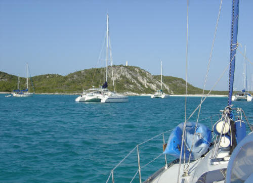
The first sight of New
Providence Island and Nassau is the Atlantis Resort on Paradise Island which
forms the northern bank of Nassau Harbour. The harbour is very busy with
cruise ships, other commercial craft and many private yachts. Inside the
harbour are the exclusive marinas of the Atlantis Resort and Hurricane
Hole, adorned with very expensive mega-yachts for the mega-rich. The harbour
also has some interesting currents, sand bars, tour boats, ferries, jet-skis
and crazy local fisherman who only know the “Throttle wide open” position.
Every boat entering Nassau Harbour has
to call Harbour Control to obtain permission to enter and provide details of
the boat and destination within the harbour. The same applies when leaving
the harbour. Entering marinas there is a challenge due to the strong
currents and wash from passing boats. We night-stopped on Sunday 2nd April at Nassau
Yacht Haven to clear customs and immigration. Within half an hour of our
arrival, two officials from customs & Immigration came to the boat, despite
it being Sunday afternoon, for a no fuss clearance.
Midday on Monday, we staged out to
nearby Athol Island, just outside Nassau Harbour, ready for an early start
on Tuesday for our 40 mile run to The Exumas. |
|
|
|
|
|
|
|
|
|
Shroud Cay, Exumas |
|
|
|
4 to 7 April 2006 |
|


 |
|
A very light easterly/southeasterly wind meant another day of motoring as
we headed SE to The Exumas. Calm, clear, turquoise water all the way over
the banks, usually around 20 feet deep. We anchored on the west side of Shroud Cay.
What a find! Shroud Cay is an archipelago of small islands interlaced with
fascinating mangrove creeks winding around what at one time would have been
a fantastic lagoon. There are many juvenile fish in the creeks and the
beaches on the eastern Exuma Sound shoreline are some of the best we have
seen. It would be easy to spend a couple of weeks at Shroud. This area is
included in the Exuma Land & Sea Park, so is a "No take zone." No fishing,
no conching, no lobsters. We kayaked through many of the creeks, but still
have to return to complete those we missed. The picture on the left shows
one of the creeks that starts on the banks on the western shore and emerges
here into Exuma Sound. It's quite a paddle, but worth every minute!
Although we could have stayed longer, we decided to move further south as
there was some squally weather due, so on Friday We had stayed in touch with
Phil & Judy on their catamaran "Take Two" whom we met in Spanish Wells and
the Abacos last year. We knew they were well ahead of us and heading north
from George Town. We managed to exchange a couple of emails to see if we
could meet up in the Exumas. By total coincidence, they and we both decided
to use the same anchorage to intercept each other and arrived there an hour
apart. It was great to hear them call Dream On on the VHF as we have been
sadly lacking any radio contact on this trip so far.
Having established by
radio that we were both heading for the same anchorage at Warderick Wells,
just outside Exuma Park headquarters, Phil & Judy were waiting with dinner
when we arrived. It was great to see them. |
|
|
|
|
|
|
|
|
|
|
|
|
|
|
|
Warderick Wells, Exuma Park |
|
|
|
8 April 2006 |
|

|
|
How wonderful to be back within VHF
range of Exuma
Park. We could hear Judy's familiar voice over the radio, efficiently
handling the daily mooring assignments. After saying goodbye to Phil & Judy
and "Take Two" on Saturday morning as they headed north, we called Judy and were lucky enough to
be allocated a mooring buoy in the park. We also timed our
arrival with the weekly social gathering around the bonfire on the beach and
met some of our fellow cruisers visiting Exuma Park.
Unfortunately, Adam &
Louise were not able to fly out and join us as hoped, so time to move
further south. A nasty batch of weather blew through most of the Bahamas
during the week, so we stayed at Exuma Park, while Geoff completed a few
more jobs on Dream On and Iza volunteered in the park.
We were persuaded to stay long enough to enjoy the annual Easter pot luck
buffet lunch at the park accommodation. Around 50 cruisers there and a
fantastic array of food, the centre of which was an enormous ham supplied by
the park. |
|
|
|
|
|
|
|
|
|
George Town, Great Exuma Island |
|
|
|
|
|


 |
|
Finally departed Warderick Wells on
Monday 17th April and headed south across the banks to Fowl Cay at Dundas
Rocks, still within the park boundaries so still in a no fishing area. There
are caves here for snorkeling, but we decided to do that another day, so
anchored there overnight.
The following morning, we left through the cut out into the deep Exuma
Sound and spend a few hours fishing, not catching, before turning into Pipe
Creek, one of our favourite stops from last season and anchored by Joe Cay.
More fishing from the boat while anchored at Joe Cay, but still no
catching. When you have to fish, fish in comfort!
When we left Joe Cay, we decided to take the channel down through Pipe
Creek. Full of sand bars with the shallow depth alarm ringing most of the
way. We grounded once on sand but were able to reverse out easily and take
another route. Once south of Thomas Cay we exited into Exuma Sound through
the cut between Thomas and Over Yonder Cays. This was very narrow, with very
strong current but with deep clear water.
We had thought we might make George Town from Pipe Creek, but the wind
failed us so we had a steady motor at 5 knots on calm sea with two lines
out. Caught a cero mackerel, quite small but a good lunch.
A cruiser we had met along the way told us that the Four Seasons Resort
on a head of land at the beginning of Great Exuma Island, had now opened its
marina with five star facilities. The Marina at Emerald Bay. Not quite the
introductory price we had been told but we just had to take a look before
hitting George Town harbour.
Although still work in progress, this marina will be something special.
Very large, with first class facilities, luxurious captain's lounge, free
coffee, orange juice, Danish pastries and muffins for breakfast. Free wi-fi
internet at the boat. Free laundry. Free shuttle to the very good grocery
just up the road. Free use of the Four Seasons resorts gym and beach.
Also, the marina was close to the airport where we were expecting a
replacement boom vang to be delivered. We arrived in the marina at 1.30pm on
20th. The boom vang arrived in Fort Lauderdale at 11.00am the same day, was
on a flight at 1.00pm, in George Town by 2.30pm cleared from customs and on
the boat by 4.00pm. Pretty efficient. Thanks to John & Mikki Powers in Vero
Beach for coordinating all of that.
We met up with Larry & Dorothy Thompson on board their trawler "Changes
in Attitudes" in the marina. They were next to us in the mooring field in
Exuma Park.
21st April, we are full of fuel, full of water, have visited the grocery
and ready to move into George Town harbour. We also arranged a curiosity
visit to the condos and penthouses being built in this superb development
around the marina, starting at a mere $1.2 million plus!
Chose a bad day
to move. Although only 8 miles down the coast of Great Exuma Island to
Elizabeth Harbour, George Town, the sea was rough and both wind and sea were
right on our bow. Our main GPS also failed on this trip. We used a handheld
GPS to assist in finding the complicated route into the harbour avoiding the
many shoals. Not too many boats in the harbour, (10 miles long, 1 mile
wide), probably around 150-200 boats.. As we reported in our first visit to
George Town last season, the big harbour bounded by Great Exuma to the south
and Stocking Island to the north, has many good anchorages and beaches, plus
good access to some fantastic beaches on the Atlantic side of Stocking
Island. It is an extremely social place with many cruisers spending the
whole season here. It's a little too much for us so we want to move on to
Conception and Turks & Caicos. But first, there is the George Town
Family Regatta. Many islands send in locally built sailing boats in
three classes for this major event. These boats have enormous traditional
canvas sails that are extremely heavy and difficult to manage. Each boat has
more crew than it appears there is space for and they look very unstable.
Instead of trapezes for crew to balance a healing boat, they use a plank.
This plank then has to be deftly maneuvered across the boat during a tack.
We waited in George Town to watch the first day of races before heading off
to Conception. |
|
|
|
|
|
|
|
back to top |
|
|
|
Link to Bahamas Heading South - Photos
|
|
|
|
|
|
|
|
|
|
|
|
|
|


