|


| |
Chesapeake Bay
Potomac River
Mount Vernon
Washington, DC
|
|
|
|
|
|
|
|
|
Chesapeake Bay to the Potomac |
|
6 November 2005 |
|

|
|
We finally dragged ourselves away
from the enjoyment of Annapolis on Sunday 6th November and headed out into
Chesapeake Bay along with hundreds of other boats. Wanting to test our newly
installed alternator charging system and with Iza’s ribs still on
the mend, we decided to make our first hop fairly short.
After an uncomfortable one hour in the Chesapeake with
a 3 foot sea and winds up to 22 knots, we turned into the
combined estuary of South and West Rivers, headed for West River and then
turned into Rhode River. Total journey 13 nautical miles.
|
|
|
|
|
|
|
|
|
|
Rhode River
|
|
|
|
7 November 2005 |
|

 |
|
Rhode River was a great choice. After the enjoyable bustle of Annapolis,
Rhode River was a superb contrast. Quiet, surrounded by banks of trees in all
shades of autumnal colours and all we could hear in the evenings were
Canadian geese.
We left the Rhode River on 7th back out into Chesapeake Bay which is 6
miles wide at this point. As we turned south we noticed the US Navy frigate
that had been anchored off Annapolis was also heading south. After 9/11 and
the USS Cole incident, all boats have to stay well clear of US Navy vessels.
We listened to radio calls from the frigate to various boats to confirm they
would stay well clear. Many boats also called the frigate to wish them a
good journey down the bay. The frigate's officers did not seem too sure how
to respond to such contact. Maybe we should have invited them for tea?
|
|
|
|
|
|
|
|
|
|
Solomon's Island |
|
|
|
8 November 2005 |
|


|
|
That night we anchored at Solomon's Island, a mini Annapolis with boats
and marinas everywhere, a great maritime museum and best of all a bakery and
a West Marine shop within walking distance.
We departed Solomon's Island on Tuesday 8th to make the final hop into
the Potomac. This trip took us past one of the many
US
Navy target ranges.
Each side of the target range was
patrolled by a "Range
Boat." easily identifiable by
the antennas on board. These guys are there to warn off all recreational
boats that stray into the area on an active day. Tuesday was an active day,
so we had to divert around this, adding a few miles, but giving us a better
view of the coast line. At this point the Chesapeake is around 10 miles
wide.
On our way south down
Chesapeake Bay, we
passed Calvert Cliffs, an area of prehistoric fossils. In the Solomon's
Island
museum there is the fossilised skull of a 28 foot whale that was probably
killed by the sharks teeth buried in its skull. The size of the teeth
indicate a shark 50 foot long weighing over 50 tons. Scary!
Fish trap markers are laid like minefields in the entries to all rivers
along Chesapeake Bay and often right in the navigable channel. The floats
themselves are not a danger, but the rope tethers to the fish traps below
are propeller shaft killers. The water is too darn cold to have to dive on
our propeller to clear a rope jam.
One of the greatest inventions of mankind is the chartplotter. In these waters,
the charts are accurate to within a couple of metres. Connected to the
Autopilot, the system can be set to steer a heading, follow a route of
waypoints, steer to a wind angle and wake you up if the anchor is dragging.
We are always backed up by old fashioned paper charts and we only use the
chartplotter in tight areas as a guide to what lies ahead and channel
routings.
The second greatest invention of mankind is our latest gizmo, a wireless
remote control for the system. With this we can steer the boat remotely from
anywhere on board, plus view depth, heading a speed data. The reason we
mention this here is that it is a great tool for steering the boat remotely
through a minefield of fish trap markers. |
|
|
|
|
|
|
|
|
|
Potomac River |
|
|
|
9 November 2005 |
|
Canoe Neck
Creek
 |
|
We
entered the Potomac River heading for Washington,
approximately 90 nautical miles upstream. The river is around 6
miles wide at the estuary. We
had been warned of rough water at the entry where tides and wind meet
and of heavy river traffic.
But, we
entered on absolutely flat, glasslike water
with no
other boat in
sight. After a very sunny run down the coast, we now had hazy grey
skies causing the Potomac ahead to merge with the sky in an eerie grey haze.
Quite uncanny.
The river was so
quiet, we could have
been on the Amazon,
Orinoco or the Mississippi 300 years ago, We half expected to be greeted by
natives in canoes and here we are heading for the capital city and seat of power. After
traveling for
around 20 miles, we still had seen no other traffic.
We spent
Tuesday night in a very small
cove off Canoe Neck Creek on
the west side of the Potomac. Only room for one boat and that
was us. Arrived
as the sun was setting, but awoke on Wednesday morning
surrounded by fog, so
had to delay
leaving, which reduced our travel for the day as the daylight hours are much
shorter now.
|
|
|
|
|
|
|
|
10 to 11 November |
|
.Mattawoman
Creek |
|
Wednesday night -
.After
passing under the 301 highway bridge and some pretty menacing looking
power cables, we reached Mattawoman
Creek, now only 25 nm from Washington and spent the night there. We knew
there was a cold front coming through early Thursday with winds forecast up
to 40 mph. To reach the best anchorage in the creek with deeper and wider
water, we had to follow a
narrow meandering channel of only just over 6 feet deep according to the
charts. Unfortunately, there had been some shoaling and we came to a sudden
stop in 5 feet of water on a mud bottom. It was soft enough to reverse out, so we anchored in
less sheltered water than we had hoped.
The wind started
during the night and we were being held by the current at 90 degrees to the
wind, when the wind gusted broadside the anchor was eventually dragged
through the mud and by morning we had moved far enough to have to re-anchor
fairly rapidly, and IT WAS COLD! We spent Thursday on hot drinks and good
books
while it blew through so lost a day there.
|
|
|
|
|
|
|
|
|
|
Mount Vernon |
|
|
| |
|
|


 |
|
George Washington was a farmer
before he became a politician. He inherited the estate at Mt. Vernon, just
south of Washington from his older half brother when he was 27. He expanded
it to 8000 acres and became a pioneer farmer introducing new crops to the
area that did not deplete the soil and new crop rotation techniques. He also
designed a circular barn on two levels so that horses could trot around the
upper level over the wheat so the corn would be separated by their hooves
and drop through the floor boards where it would be collected. Previously
this was done outside manually or with horses, losing a great deal of the crop into the
ground or blown away on the wind. A small part of the original area
remains and is preserved and in 2002 they rebuilt the barn to George
Washington's original design. The mansion and many of the original buildings
are also preserved.
Although the Potomac River is quite wide for most of the journey to
Washington, the majority of the width is too shallow for larger boats or
those with a deep keel like Dream On. As we drew closer to Washington we had
to be more careful to stay within the narrowing deeper water. At Mt. Vernon,
a channel had been dredged into a jetty so that boats can
visit. Visits are limited to 2 hours and there is only room for one of Dream On's length. We pulled in there long enough for a tour of
the estate and lunch before heading off for an anchorage just south of the
Woodrow Wilson drawbridge on the way into Washington. |
|
|
|
|
|
|
|
|
|
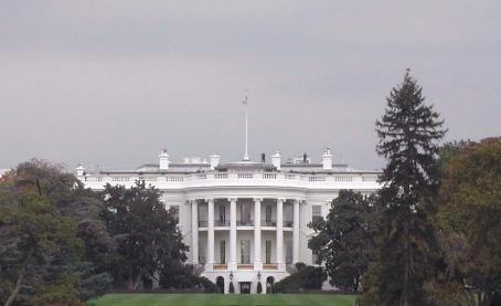
Washington, DC |
|
|
|
12 to 18 November |
|

 |
|
No doubt as a result of 9/11, there
is a great deal of military helicopter activity as Washington is approached.
This was particularly true around the Quantico US Marine headquarters, where
we could hear some target practice with heavy munitions in the distance and
were closely inspected by a Chinook helicopter several times as it appeared
to be patrolling the Potomac. Also Washington has a very busy downtown
airport, Ronald Reagan Washington National Airport. Traffic landing from the
south approaches along the last section of the Potomac, so the skies are
very busy.
Dream On's mast is too high to go under Woodrow Wilson Bridge. Unlike
most drawbridges in the US which open at regular intervals or on request,
the Wilson Bridge is on the main Washington ring road so will only open for
recreational traffic between the hours of midnight at 5am Monday to Friday
and 10pm to 7am weekends and holidays.
We planned to book an early morning opening on Saturday so we could enter
Washington in daylight. However, as Friday was Veteran's Day, a holiday, the
bridge advised us to join a previously booked opening for 10pm that night.
This meant arriving in Washington in the dark. Another challenge!
We anchored just south of the bridge in Smoot's Cove for 5 hours and pulled out of
there at 9.30pm to head out into the channel. First we had to find the correct route through the new bridge
construction and this meant looking through all the gaps in the new bridge
to find the drawbridge section of the old bridge. After finding a group of
unlit construction barges in the middle of the river and avoiding them, we
found the correct, and totally unmarked entry.
Although it was night, the moon was up and
there was sufficient light from the city of Alexandria to our left and
Washington ahead to see fairly well. The river widened to around two miles
again and as we approached Washington, we passed quite close to the airport
and its dazzling lights. Still very busy at 11pm. All the way from the
bridge we could see the illuminated Washington Monument and the white dome
of the Capitol building.
At Washington, the Potomac splits into two, the Potomac goes left to the north west and the Anacostia River to the north east. Washington City sits on the peninsular
between these rivers. As the Potomac turns off to the left, there is the
entry to Washington Creek, which is separated from the Potomac by a long
slender island containing Potomac Park and the Jefferson memorial.
The creek runs parallel to the Potomac and rejoins it 1
mile further north, close to the Jefferson Memorial. The marinas and
anchorage are in Washington Creek. Again, we were the only boat moving and
the creek was wider than expected so there was no difficulty in finding
anchoring space in the area opposite the Capital Yacht Club. (Only one other
boat was anchored out).
As recommended in our waterway books, we immediately called the Washington Marine Police to inform them of our
arrival, (another post 9/11 requirement). No problem
there and a "Welcome to Washington, enjoy your stay."
|
|
|
|
|
|
|
|
|
|
Washington, DC |
|
|
| |
12 November 2005 |
|

 |
|
Saturday morning, 12th November, we awoke to the sound of bagpipes!
Moored at the yacht club directly opposite was the mega-yacht "The
Highlander" with some kind of expensive reception on board. We
learned later that the boat belongs to Malcolm Forbes (the publisher). There
was a piper on the top deck welcoming guests. We made the 2 minute dinghy
ride to check in at the Capital Yacht Club which offers shower, laundry and
wi-fi internet connection to anchored yachts for a small fee. The Capital
Yacht Club looks like an old gentlemen's club and we were made very welcome.
However, the real bonus of our anchorage was that we could see the Washington Monument
from the boat and it was only 10 minutes walk from the yacht club to the
National Mall, where the Monument stands to the west and the Capitol to the East. We
really were right in the centre of Washington. Later we walked to the
original building of the Smithsonian, "The Castle" which stands on the side
of The Mall and was within 10 minutes of leaving the boat.
While in Washington, we visited a number of the Smithsonian
Museums, the Art Museum, the American History Museum, the Air & Space Museum
and the Hirshhorn Museum. Just 5 minutes walk away, and all free.
Back on board in the evenings for a gin and tonic in our little oasis, with a view of the
Washington Monument to the north, the bustle of central Washington to the
west and Potomac Park behind us. Beyond the park, the Potomac and beyond
that, Arlington National
Cemetery and the Pentagon building. On the Wednesday, a serious cold front
blew through. We were fairly well protected in Washington Creek, so no
dramas, but a vicious temperature drop from 78°F at
midday to 50°F by 4pm and by Thursday morning 40°F.
We were given a bridge opening for 4.30am
Friday morning, ending an enjoyable 6 days in Washington.
With the present unsociable drawbridge
schedule and new bridge construction activity, there are very few visiting sailboats.
In fact we seemed to be the only visitors in town with a mast that required a bridge
opening. |
|
|
|
|
|
|
|
|
|
The Potomac River, Southbound
|
| |
18 to 21 November
2005 |
|


 |
|
So, we awoke at 3am on Friday 18th
in order to be at the bridge by 4.30am. IT WAS SO COLD. There was ice on the
decks!
After an uneventful journey out of Washington, we found the bridge
opening in the dark. Road traffic was still heavy mostly with heavy trucks
so we had to wait a little while for the opening. Once through the
drawbridge and carefully through the new bridge construction, we then had to
spot any unlit anchored construction barges. We carried on down the river in
the dark and on into daylight to reach our anchorage in the early afternoon
to catch up on sleep.
We spent our first night back on the river in Port Tobacco River,
approximately 45 miles down river. A very pleasant anchorage but the
temperature that night was in the mid 20's F! (-4°C).
Now, Dream On is a tropical boat and not equipped for these temperatures.
Our cabin dropped to the mid 30's F (+2°C) that
night. Not for wimps this cruising game!
When we left the anchorage early on Saturday morning, it was beautifully
clear, but again, we had ice on the decks for the first 3 hours.
Sunday night and another 45 miles down river almost at the mouth of the
Potomac, we turned into St. Mary's River. Fabulous spot. We were able to
moor at the St. Mary's College jetty for the night free of charge and walked
around the newly preserved archeological site of the first landings in
Maryland and the first state capital of Maryland dating back to 1634.
St. Mary's River was one of the most scenic rivers we have visited, with
some fabulous houses in beautifully landscaped gardens. This was our last
anchorage in the Potomac River. From here we headed back into Chesapeake Bay
and south towards Norfolk, Virginia. |
|
|
|
|
|
|
|
back to top |
|
|
|
Link to Washington, DC - Photos
|
|
|
|
|
|
|
|