We left St. Mary's River on 21st
November, and made the 45 mile journey to Deltaville on Jackson Creek off
the Piankatank River. The entry to Jackson Creek was entertaining. The
channel is very narrow, with a couple of 90° bends, one
of which is only a few yards from shore. We stayed one night in Jackson
Creek.
As we left Deltaville the following morning, we
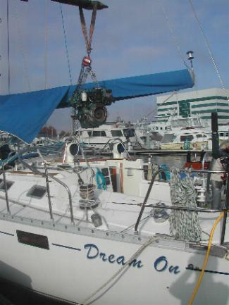
experienced some slipping of the transmission in forward gear. We topped up
the fluid and it seemed okay, so we decided to carry on,
intending to
make one more stop on the way to Norfolk as we knew that a heavy cold front
was approaching. However, the water was calm, we had some westerly wind and
were making good time to start with, so decided to continue to Norfolk. The
visibility was poor due to low cloud so we had to keep an eye on our radar
to identify anything more than a mile away. It also drizzled all day making
it a miserable journey.
All the way down, we heard US Navy warships and large commercial vessels
on the radio, heading in or out of this very busy port. Norfolk is the
world's largest naval base. The entrance to Elizabeth River, on which
Norfolk sits, is at Hampton Roads, one of the busiest sections of waterway
in the world. Visibility had further reduced as we came closer, and even
though we were motor-sailing with genoa raised, we were losing speed as the
transmission started slipping again.
As we entered the Elizabeth River, it started to rain more heavily, so we
dropped the genoa as this partly obscures our forward vision. Then we heard
a radio call from an aircraft carrier coming in behind us. We could not see
it due to low visibility and it was probably still 5 miles away, but that
was enough for us to open 30% of the genoa again to give us some extra
speed. Once through the Hampton Roads entrance, the river opens very wide
into a huge commercial anchorage. We headed for this area knowing we would
be well clear of the aircraft carrier there.
All vessels have to stay a minimum of 500 yards from any US Naval vessel
and as we motor-sailed through the anchorage with large commercial vessels
to the right, we could see the line up of naval vessels to the left. At
least 6 aircraft carriers and one more behind us. Once past those we were
able to come back in towards the main Elizabeth River channel as it narrowed
towards Norfolk, watching out for tugs with barges, US Coast Guard vessels,
commercial and private vessels of all types coming from all directions.
Heading up the Elizabeth River amidst this traffic, the transmission was
deteriorating rapidly and we were only making 3 knots. Suddenly, a squall
blew through, the water picked up and we had cross winds of over 20 knots
with regular 29 knot gusts.
By this time it was almost dark, the rain was falling very heavily and
with so little speed these gusts regularly knocked us off course, but we
managed to stay in the channel with the wind at 60° off
our port bow. However, just before Norfolk, the river turns 50° to port. We
tried to cut the corner to give us as much distance up the river before
succumbing to the head wind and taking in the genoa. As we passed the wider
part of the river where the western tributary separates, a gust of wind
caught us just as the transmission finally gave out. We were very close to
the traffic lanes of the main river and the western branch and much too
close to the Maersk container terminal, so we dropped the anchor and with no
way of obtaining any more forward action from the transmission, (reverse was
still working), and called Tow Boat US.
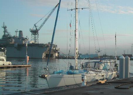
Two hours later we were towed up the
river, past the Norfolk water front on the left and into the Ocean Marine
Yacht Center on the right, in Portsmouth, right opposite the naval shipyard
of Gosport.